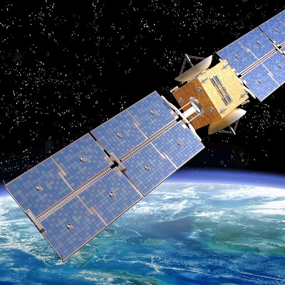
Remote sensing is het verzamelen en analyseren van informatie over het aardoppervlak zonder fysiek contact, meestal via satellieten, drones of vliegtuigen. Deze technologie wordt breed ingezet in domeinen zoals geografie, milieuonderzoek, landbouw, stedelijke planning en klimaatwetenschappen.
--> Ga direct naar de opleidingen
Opleidingen in Remote Sensing
Verken de wereld van Remote Sensing, een innovatieve technologie waarbij informatie over het aardoppervlak wordt verzameld zonder direct contact met het gebied in kwestie. Door gebruik te maken van sensoren op satellieten, vliegtuigen of drones kunnen gegevens worden verzameld over landgebruik, vegetatie, waterkwaliteit, stedelijke ontwikkeling en nog veel meer. Remote sensing speelt een cruciale rol in milieuonderzoek, geografie, landbouw, bosbeheer, klimaatmonitoring en rampenbeheer.
Opleidingen in remote sensing bieden een diepgaand inzicht in hoe deze technologie werkt, welke soorten sensoren en platforms worden gebruikt (zoals optische, radar- of thermische systemen), en hoe je de verzamelde gegevens kunt interpreteren en analyseren. Er wordt veel aandacht besteed aan GIS-integratie (Geografisch Informatiesysteem), beeldverwerking, classificatietechnieken, en het gebruik van gespecialiseerde software zoals ENVI, ERDAS Imagine of open-source tools zoals QGIS.
Tijdens deze opleidingen leer je hoe je remote sensing kunt toepassen in concrete projecten, zoals het volgen van ontbossing, het analyseren van verstedelijking, het detecteren van gewasgroei, of het monitoren van overstromingen en droogte. Zowel theorie als praktijk
De opleidingen richten zich op studenten, onderzoekers, milieuwetenschappers, geografen, landbouwkundigen en professionals in ruimtelijke planning. Er zijn zowel introductiecursussen voor beginners als gespecialiseerde trajecten voor wie zich verder wil verdiepen in toepassingen of analysemethoden.
Ontdek hier het uitgebreide aanbod aan remote sensing-opleidingen en ontwikkel de vaardigheden om met deze technologie waardevolle ruimtelijke inzichten te genereren en bij te dragen aan duurzame oplossingen voor complexe problemen.
Overzicht cursussen Remote sensing

Doelgroep: Alle niveaus..
Wat je leert: Google Earth Engine , Remote Sensing/Earth Observation , Time Series Raster Analysis

Doelgroep: Voor beginners..
Wat je leert: Learn the basics of remote sensing principles , Master the image processing skills: mosaicking, compositing, resampling, reprojection, spectral unmixing, and classification , Access and download freely available Earth observation satellite data using cloud platform

Doelgroep: Voor beginners..
Wat je leert: Understand basic concepts of Remote Sensing. , Understand the physical principles behind the interaction of EM radiation and the multiple types of soil cover (vegetation, water, minerals, rocks, etc.). , Understand how atmospheric components can affect a signal recorded

Doelgroep: Alle niveaus..
Wat je leert: Remote Sensing Background , Types of Remote Sensing , Applications of Remote Sensing data

Doelgroep: Alle niveaus..
Wat je leert: Students will learn to work in TrendsEarth in QGIS , To learn how to conduct land degradation analysis in QGIS , Get informed about Sustainable Development Agenda and Sustainable Development Indicators (SDGs)

Doelgroep: Voor beginners..
Wat je leert: Download, process and visualize various satellite data for drought monitoring application , Understand the advantages of using satellites for drought monitoring , Generate various visualizations including time series and histogram charts from remote sensi

Doelgroep: Voor gevorderden..
Wat je leert: Concepts/basics of Convolutional Neural Networks , Visualizing Hyperspectral data in Google Colab , 1-Dimensional Convolutional Neural Network development

Doelgroep: Voor gevorderden..
Wat je leert: Understand fundamentals of change detection techniques , Apply advanced image analysis techniques to the real-world data , Working with the open-source GIS software & tools

Doelgroep: Voor gevorderden..
Wat je leert: Learn supervised machine learning for image classification using R-programming language in R-Studio , Learn theoretical background of Machine Learning , Apply machine learning based algorithms (random forest, SVM) for image classification analy

Doelgroep: Alle niveaus..
Wat je leert: Basics of GIS in Depth , Georeferencing , Projection system understanding and use.

Doelgroep: Alle niveaus..
Wat je leert: Use ENVI software for a variety of image processing techniques , Understand basic tools in ENVI , Radiometric Calibration

Doelgroep: Alle niveaus..
Wat je leert: Download, process and visualize various satellite data for water resources application , Understand the advantages of using satellites for Water Resources , Generate various visualizations including time series and histogram charts from remote sens

Doelgroep: Alle niveaus..
Wat je leert: Learn to apply land use land cover classification using satellite data , Land use land cover change detection analysis , Perform accuracy assessment of land use classifications

Doelgroep: Geographers, Programmers, geologists, biologists, social scientists, or every other expert who deals with GIS maps in their field..

Doelgroep: People with prior expereince of working spatial data,GIS analysts,Ecologists,Forestry and Conservation Practioners,Geographers,Geologists..

Doelgroep: Anyone interested in learning how to process and analyze Earth observation data with Google earth Engine,Anyone interested to learning the basics of satellite remote sensing..
En

Doelgroep: Academics,Researchers,Anyone who wants to learn about and how to use remote sensing,Anyone who wants to use spatial data to solve geological and environmental questions..
Do you find that other remote sensing courses are too short and vague, and do not prepare you for real world problems? Are you looking for a course that goes IN-DEPTH and teaches you all the fundamentals of remote sensing? My course provides a solid found