Vind een opleiding

Opleidingen - Landmeten met drones

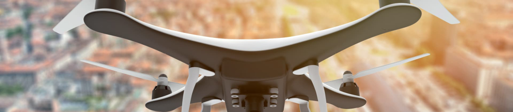
Ontdek op deze pagina een uitgebreid aanbod van cursussen over landmeten met drones, ideaal voor iedereen die wil leren hoe moderne drone-technologie kan worden toegepast in het veld van geografische informatiesystemen (GIS) en landmeten. Of je nu een beginnende dronepiloot bent of een ervaren landmeter die zijn technologische vaardigheden wil uitbreiden, onze cursussen bieden de technische inzichten en praktische vaardigheden die je nodig hebt.

Je vindt hier cursussen die je leren hoe je drones kunt inzetten voor nauwkeurige topografische metingen, volumetrische berekeningen, en het monitoren van landgebruik en -ontwikkeling. Leer alles over de selectie van de juiste drones en sensoren, het plannen van vluchtmissies, en het verwerken van luchtfoto's om nauwkeurige 3D-modellen en kaarten te genereren. Deze cursussen bieden ook diepgaande kennis over het integreren van drone-verzamelde data met traditionele landmeetkundige methoden en GIS-software.

Of je doel nu is om efficiëntie te verhogen in uitgebreide landmeetprojecten, de nauwkeurigheid van gegevensverzameling te verbeteren, of nieuwe diensten aan te bieden binnen het landschapsontwerp, onze cursussen bieden praktische begeleiding en deskundige instructies. Je leert van ervaren professionals in de drone- en landmeetkunde die hun expertise delen door middel van interactieve lessen, hands-on trainingen, en real-world case studies.

Onze cursussen in landmeten met drones zijn toegankelijk voor deelnemers van alle technische niveaus en bieden flexibele leertrajecten die kunnen worden aangepast aan jouw specifieke professionele doelen en operationele behoeften. Aanvullende bronnen zoals toegang tot de nieuwste drone-technologie, software tutorials, en professionele certificeringsmogelijkheden kunnen je leerervaring verder verrijken en je voorbereiden op succes in de snel evoluerende wereld van geografische dataverzameling.


Overzicht cursussen Landmeten met drones


Doelgroep: Heb jij een basiskennis van digitale fotografie? En wil jij prachtige beelden maken zowel stilstaand als bewegend, vanuit de lucht? Dan is deze opleiding Dronefotografie alvast een echte hoogvlieger!..

Type Opleiding: klassikaal op locatie     Richtprijs: € 499     Taal: Nederlands     Duur: 5 groepslessen van 3 u/les     Locatie(s): Gent     Partner: Centrum Voor Avondonderwijs    

Weten hoe te fotograferen met een drone is een must voor elke fotograaf. Zowel voor huwelijksfotografie, immofotografie als bedrijfsfotografie is dit een veelgevraagde skill. Je camera hangt als een arend in de lucht, waardoor je de meest spectaculaire plaatjes schiet. Je docent toont je in enkele theoretische en praktijkgerichte lessen hoe je je drone bestuurt en hoe je de technische kant van
Meer info

Doelgroep: Dronepiloten categorie SPECIFIC. Je bent reeds houder van een bewijs van bevoegdheid als bestuurder van een RPA (klasse 1, afgegeven overeenkomstig het koninklijk besluit van 10 april 2016) en je hebt het vaardigheidscertificaat van piloot op..

Type Opleiding: klassikaal op locatie     Taal: Nederlands     Partner: Syntra West    

Uitgebreide voorbereiding op het vliegen in de SPECIFIC categorie en dit met een optimale tijdsinvestering. In de categorie SPECIFIC zijn UAS-vluchtuitvoeringen toegestaan op basis van een verklaring (standaardscenario STS-01), een exploitatievergunning of een certificaat van exploitant van lichte UAS (LUC). Indien men vluchtuitvoeringen wil uitvoeren die niet in een standaardscenario passe
Meer info

Doelgroep: Gecertificeerde dronepiloten die hun diensten willen aanbieden in de landbouwsector...

Type Opleiding: klassikaal op locatie     Taal: Nederlands     Partner: Syntra West    

Zijn drones de tractoren van de toekomst? Bij precisielandbouw krijgen planten (of dieren) met behulp van technologie, heel nauwkeurig die behandeling die ze nodig hebben. Hiervoor worden verschillende technologieën ingezet zoals GPS, sensortechnologie, ICT en robotisering. Techniek kan helpen bij strategische besluiten op bedrijfsniveau, maar ook bij operationele handelingen op plant
Meer info

Doelgroep: Heb jij een basiskennis van digitale fotografie? Wil jij vanuit de lucht prachtige beelden maken, zowel stilstaand als bewegend? Waan je dan met deze opleiding alvast in de zevende hemel! Zowel voor huwelijksfotografie, immofotografie als bedrijfs..

Type Opleiding: thuisstudie     Richtprijs: € 299.00     Taal: Nederlands     Duur: 6-9 maanden gemiddeld     Partner: Centrum voor Afstandsonderwijs    

Wil jij...
professionele foto´s leren maken met je drone
handvast met jouw drone leren vliegen
weten met welke wetten je rekening moet houden als je met je drone vliegt
jouw skills als filmmaker verder verfijnen
Meer info

Doelgroep: Alle niveaus..

Type Opleiding: online/e-learning     Taal: Engels     Duur: 2 uur in totaal     Partner: Udemy     Instructeur: Dionisio gonzalez    

Join the future.
Wat je leert: Concepts behind mapping and modeling using UAVs , Different software options used to automate flights , How to turn the data taken by UAVs into maps and 3D models
Meer info

Doelgroep: Voor beginners..

Type Opleiding: online/e-learning     Taal: Engels     Duur: 2,5 uur in totaal     Partner: Udemy     Instructeur: Scott Lussier    

Install, Setup and Learn How to use Free Drone Photogrammetry Software.
Wat je leert: Download and install Free and Open Source photogrammetry software , Create 2D data products with your drone (Orthomosaics and DSMs and DTMs) , Create to make 3D data products with your drone (Models and Volume Calculations)
Meer info

Doelgroep: Drone service providers, commercial farmers, agricultural companies, academics and researchers, students..

Type Opleiding: online/e-learning     Richtprijs: Free     Taal: Engels     Duur: 1 uur in totaal     Partner: Udemy     Instructeur: Gregory Crutsinger    

We know that drones are powerful new tools for the agricultural market, but it can be difficult to navigate which cameras are the best ones for farm mapping.  The Farm Drone Sensor Showdown is your master guide to multispectral drone cameras.  These are specialized cameras that are purpose built for vegetation imagery.  They have special lens and filters specific to capturing the wa
Meer info

Doelgroep: Advanced drone pilots,Student pilots of UAV,Fisheries and oceans DFO,First Nations,Police,Boaters,Coast Gaurd..

Type Opleiding: online/e-learning     Richtprijs: €44.99     Taal: Engels     Duur: 1 uur in totaal     Partner: Udemy    

Operating your drone from a boat opens up a whole new world of opportunity for the professional and amateur drone pilot, but more skill is needed. In this practical course, you will join Capt David Carlos on board his vessel and see how to safety and legally operate your UAV in airspace, off a moving boat! We start from initial flight planning and site survey, then go to boat safety. As the course
Meer info

Doelgroep: Engineers, Architects, GIS and geomatic enthusiasts..

Type Opleiding: online/e-learning     Richtprijs: €199.99     Taal: Engels     Duur: 1 uur in totaal     Partner: Udemy     Instructeur: Golgi Alvarez    

In this course you will learn to create and interact with digital models.-Creating 3D models using images, such as the technique of photogrammetry with drones.-Use free software, Regard3D and MeshLAb-Make it using AutoDesk Recap,-Make it using Bentley ContextCapture,-Generate point clouds-Create surface in Civi3D from point cloud-Clean, thematize and export point cloud model,-Share the model to In
Meer info

Doelgroep: General Public,Graduated of any field with focus in surveying, cartography, geoprocessing and remote sensing,Surveyour Technicians/ Land Surveyours,Drone/UAV Pilots..

Type Opleiding: online/e-learning     Richtprijs: €19.99     Taal: Engels     Duur: 1 uur in totaal     Partner: Udemy     Instructeur: Guilherme Braghirolli    

The main goal of the Drone Surveying Course is to be a fast course, with all the main theoretical information, presented in a simple way. I will be showing what you need to know to start executing this kind of service, and also to better understand if you already work with it.All the topics approached on the course are considered the main structural topics to know if you want to be able to generat
Meer info

Doelgroep: Anyone from construction sector who want to incorporate drones into their operations,Anyone who wants to start a drone service business in the construction sector,Anyone who is passionate about drone applications!..

Type Opleiding: online/e-learning     Richtprijs: €99.99     Taal: Engels     Duur: 1,5 uur in totaal     Partner: Udemy     Instructeur: Huviair Technologies    

This course is the first part of the course series Ultimate Guide to Drone Applications-Construction IndustryPart 1 goes into complete detail into how you, as an employee or employer of a construction company, project management company, real estate company or a drone service providing company can use drones to increase accuracy, maximize your efficiency and cost savings i
Meer info

Doelgroep: Anyone who is passionate about drone applications!,Anyone who wants to start a drone survey business!,Anyone who wants to add drone surveying to their existing services!..

Type Opleiding: online/e-learning     Richtprijs: €99.99     Taal: Engels     Duur: 1 uur in totaal     Partner: Udemy     Instructeur: Huviair Technologies    

This course is the third part of the 3 course series “The Ultimate Guide for Land Surveying with Drones”. This part covers end to end  processes and techniques of using Ground Control Points (GCPs) for Land Surveying with Drones.  To obtain the highest amount of global accuracy in your drone mapping project, the most common and effective method is to use GCPs. We have detai
Meer info

Doelgroep: Anyone who is passionate about drone applications!,Anyone who wants to start a drone survey business!,Anyone who wants to add drone surveying to their existing services...

Type Opleiding: online/e-learning     Richtprijs: €99.99     Taal: Engels     Duur: 1,5 uur in totaal     Partner: Udemy     Instructeur: Huviair Technologies    

This course is the second part of the 3 course series “The Ultimate Guide for Land Surveying with Drones”. This part covers the steps involved after you have processed the images from your drone survey. We have detailed post processing using various software applications such as QGIS, AutoCAD, Google Earth Pro and Gimp. We've also covered how to create the best reports for your
Meer info

Doelgroep: Anyone who is passionate about drone applications!,Anyone who wants to start a drone survey business!,Anyone who wants to add drone surveying to their existing services!..

Type Opleiding: online/e-learning     Richtprijs: €99.99     Taal: Engels     Duur: 2 uur in totaal     Partner: Udemy     Instructeur: Huviair Technologies    

This course is the first part of the 3 course series “The Ultimate Guide for Land Surveying with Drones”. This part covers the basics of land surveying and how drones have revolutionized this process. We have detailed all the steps involved in flight planning and execution and how you can go about processing the images captured to get the needed outputs. This course is
Meer info